
OUR FAVORITE PACIFIC NORTHWEST WATERFALLS

The Pacific Northwest is a waterfall paradise.
Nestled in the enchanting landscape of the Pacific Northwest lies a pristine world of natural wonders, including cascading waterfalls. The PNW, encompassing the states of Washington, Oregon, and parts of Idaho, is renowned for its awe-inspiring landscapes, and its waterfalls are no exception. With more than 400 to choose from, it can be tough to know where to start. We’ve compiled a list of our 12 favorite waterfalls to get you started. Pack your hiking boots—most of these northwest waterfalls are fantastic hikes in their own right.
Washington
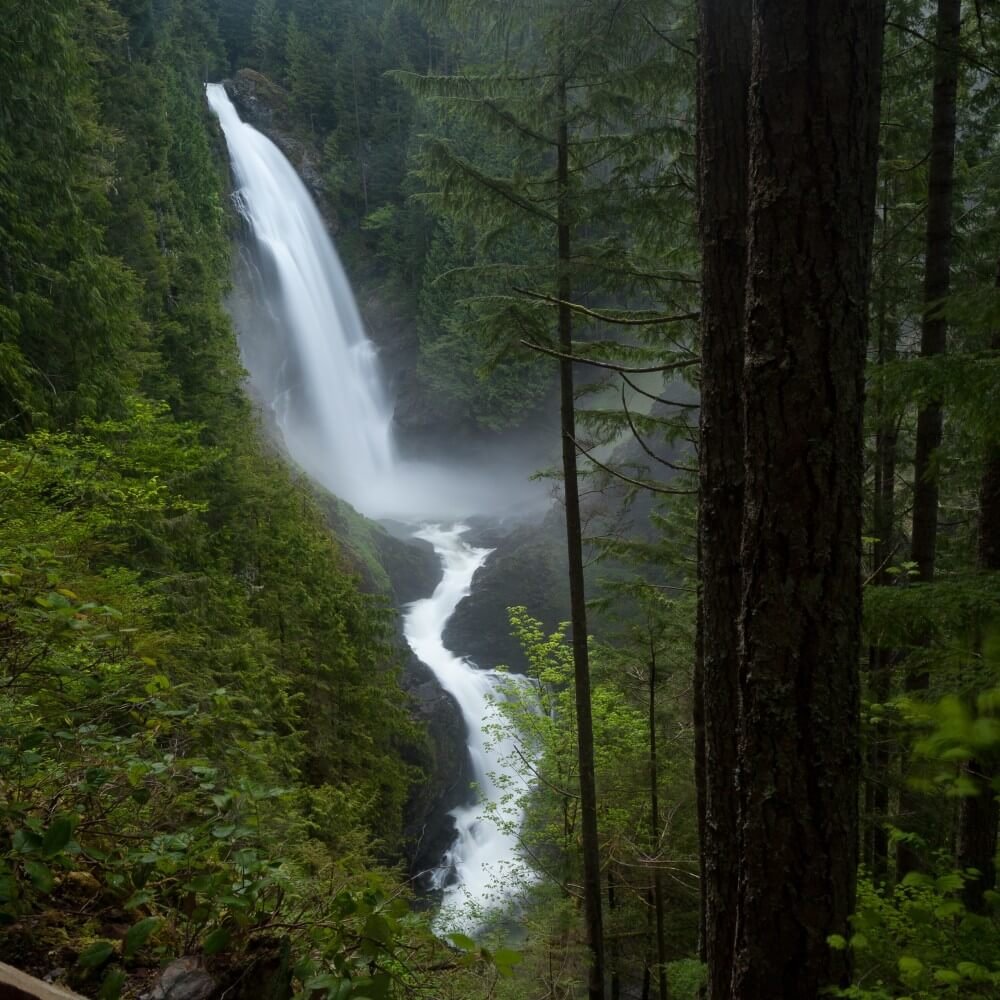
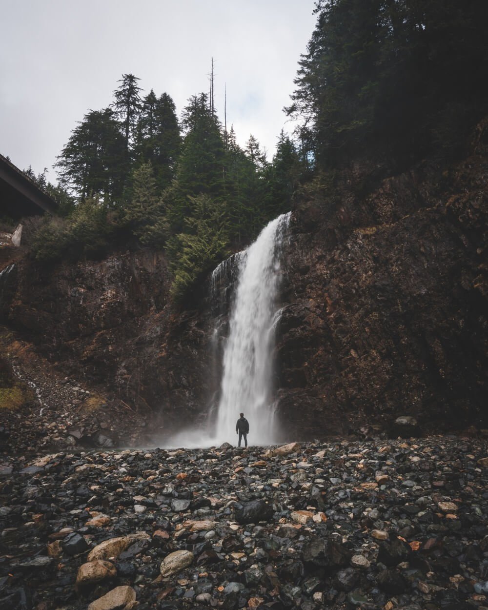
wallace falls
Early birds get the worm! This popular waterfall in Wallace Falls State Park is best explored in the morning where you can enjoy the tranquility of the area before the crowds arrive. Take the stunning Woody Trail, a 4.9-mile out-and-back winding along the Wallace River with views of the state park’s 9 dazzling waterfalls. Find the trailhead just off the parking lot, framed by the information kiosk and the restroom facilities. Trek under a pair of power lines and continue left, trading the last traces of civilization for the gentle babbling of the Wallace River as you duck under a canopy of hemlocks. You’ll encounter a split trail at the half-mile marker. The path on the right, distinguished by a wooden gate, leads to the Woody Trail. The left fork diverts to the old Railroad Grade, a longer bike-accessible path. Bikers and more seasoned visitors may swing left to explore paths that lead north to Lake Wallace, but proceed through the gate on the right to the Woody Trail if you want to spot Wallace Falls. To access the Upper Falls, there’s a 1,300 foot elevation gain. If you’re not feeling up for that—don’t fret—the Middle Falls overlook provides arguably the trail’s most impressive scenery with a panoramic view of the Skykomish River valley and the distant portrait of the Olympic Mountains trailing into the horizon. Along the route, you can stop to rest on several benches and check out what the anglers are catching.
Photo: David Lindhal
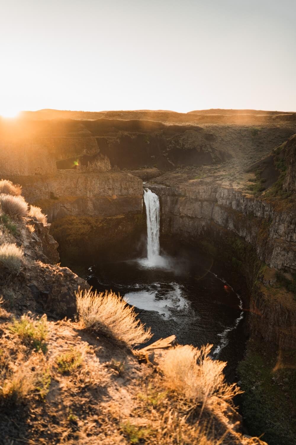
Palouse Falls
Also known as Aput Aput, meaning “Falling Water,” named by the Palouse Indians, Palouse Falls cascades 200 feet down to a churning bowl. From there, the current moves swiftly, through a winding gorge of columnar basalt, to its southern end at the mighty Snake River. The 94-acre Palouse Falls State Park is great for soaking in the views, picnicking, and birding. You may encounter the infamous yellow-bellied marmot during your visit. Many reside in the park and can be found grazing throughout the area. From the parking area, a graveled path winds for one-third of a mile around and through grassland and back. Keep an eye out for wildflowers in the spring and summer. Due to safety issues, ALL trails leading to the canyon and base of the waterfall permanently closed in 2022. Enjoy the falls from three distinct viewpoints. The lower viewpoint provides a direct view, reached by a set of steps from the main day-use area adjacent to the parking lot. The second, at the end of a paved interpretive path, tells the story of the secluded canyon. Both the interpretive path and gravel secondary parking area lead to the third and highest viewpoint, the Fryxell Overlook, offering panoramic views of the falls and Palouse River Canyon.
Photo: Toan Chu
Whatcom Falls
Explore over 5 miles of trails through the lush forest, overlooking the creek, gorge, and pools, and meandering across open meadows at Whatcom Falls Park in Bellingham. From the parking area, a WPA-built stone bridge takes you deeper into this green wonderland (you’ll find Whatcom Falls here). Connect to Bloedel Donovan Park, the Railroad Trail, or do a one-mile loop in the park by beginning in the Silver Beach Road parking area, near the stone bridge at the main falls. With playgrounds, picnic shelters, a fish hatchery, bike-friendly paths, and an off-leash dog area—Whatcom Falls Park is ideal for all ages.
Photo: Kris Debruine
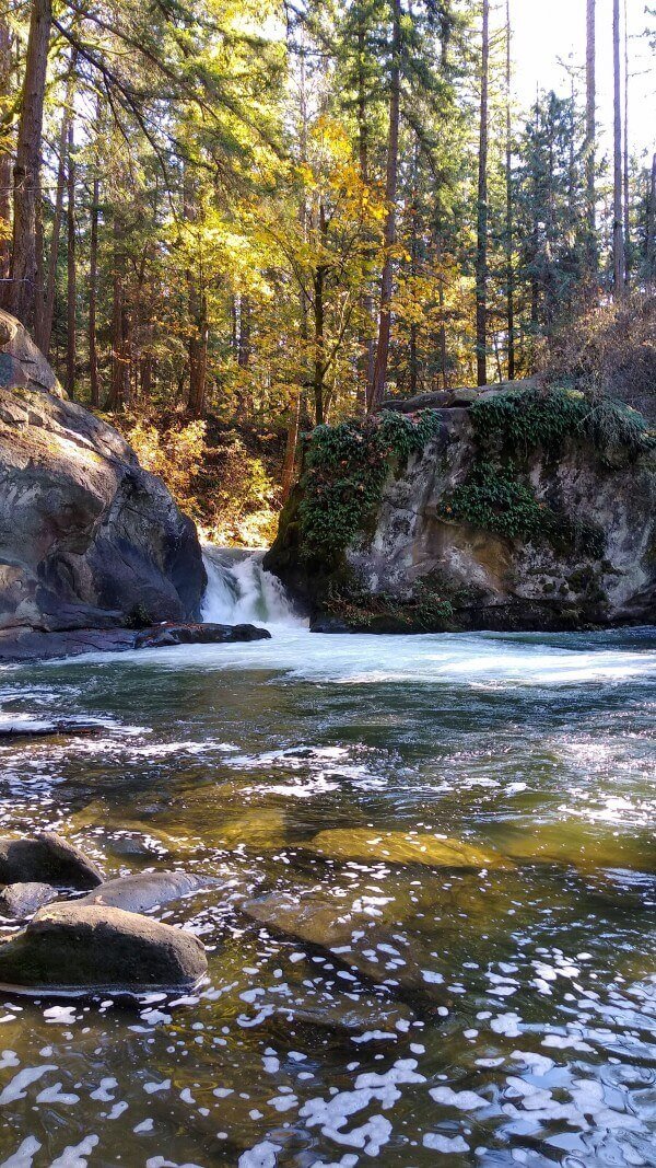
cherry creek falls
When the temps heat up, head to Cherry Creek Falls! Popular for birding, swimming, hiking, and trail running—a 5-mile round-trip trail takes you to the 25-foot Cherry Creek Falls which provides refreshingly cool water for swimming. The first half mile of the trail is private property accessed by an easement. Be on the lookout for trail signage, as it’s not always obvious. At three-quarters of a mile, you’ll cross Margaret Creek on a bridge. Shortly after that, stay left at the first junction and right at the second, ignoring any grassy overgrown roads. After climbing a short hill, stay right at the third junction and proceed downhill. At 1.5 miles, the road makes a sharp hairpin to the right. Head left on a muddy track through the woods. Stay left at the next junction to then rejoin the overgrown road. Continue straight for another mile, hopping across a few creeks. You’ll arrive at Hannan Creek, a large washout that has been leveled by machinery. Cross the creek. The trail to the falls branches off to the right just on the other side of the creek (it may be hidden from view by a large dirt pile). Follow the sound of the falls. You’ll come across a firepit area, which overlooks the falls. There’s a short path leading to the base of the falls, 2.5 miles from where you started at the trailhead.
Photo: Northwest Waterfall Survey
franklin falls
Hike the Franklin Falls Trail to catch the gorgeous 70-foot-tall Franklin Falls. The trail follows the south fork of the Snoqualmie River for a mile, skirting a canyon with glimpses of deep pools and cascades in the river below as it descends the upper South Fork Valley below Snoqualmie Pass. The trail offers an easy hike that rises gradually through old-growth forests with views of the Snoqualmie River, ending at the base of Franklin Falls. Eat lunch or cool off in the mist at the base of the falls, just be mindful of the steep and slippery descent!
Photo: Cameron Stewart
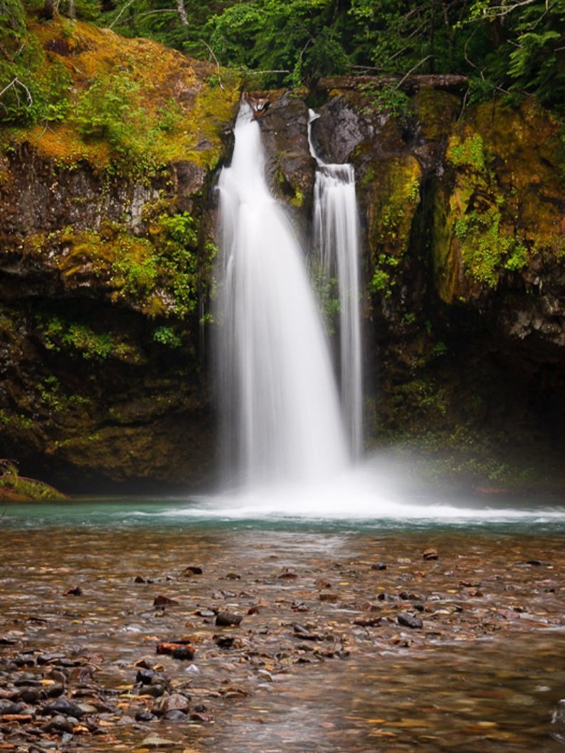
iron creek falls
Within the Gifford Pinchot National Forest, Iron Creek Falls is a beautiful waterfall close to the road, making it wonderfully suitable if you’re traveling with younger kids. Right off of Forest Road 25, head 500 feet down a wide trail to a view of the falls. The waterfall tumbles over a rock ledge more resistant to erosion than the neighboring rock. While the trail is short and moderately steep, steps make the slippery descent easier. Several boot paths are visible down to the creekside, but the trail itself ends at the viewpoint.
Photo: Northwest Waterfall Survey
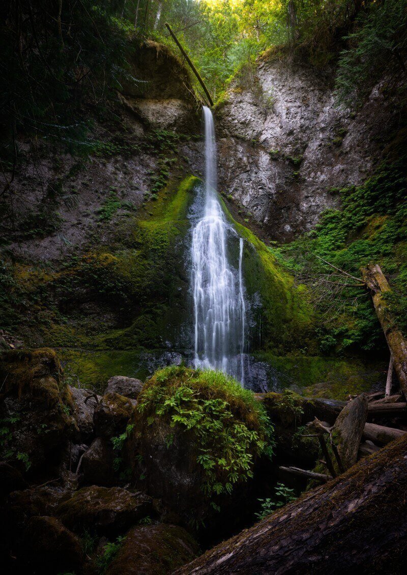
marymere falls
A short 1.8-mile roundtrip hike will take you to this stunning waterfall on the north side of the Olympic Peninsula. Once you arrive at the falls, you’ll have two different locations for viewing—from the hillside or a lower platform. You’ll start and end your hike near gorgeous Lake Crescent if you need to cool off afterward.
Photo: Intricate Explorer
Oregon
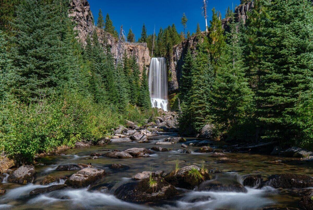
tumalo falls
Just 12 miles west of downtown Bend, the 97-foot Tumalo Falls offers a beautiful opportunity to take in a rushing waterfall just a couple minutes from the parking area. The main entrance to the falls is open mid-May through October. Near the parking area, the Lower Viewpoint offers a fantastic view of the falls and canyon. Head a half mile up to the Upper Viewpoint for a thrilling aerial perspective. For a scenic and moderate trek, continue on from the Upper Viewpoint to the North Fork Trail and return via the Swampy Lakes Trail. Known as the Tumalo Falls Loop, this 7-mile hike offers beautiful creekside views (with one river crossing), wildflowers, and several smaller waterfalls all on a tree-shaded path. Tumalo Falls is also a beautiful sight in winter! The gate at the main road is closed to vehicle traffic, but you can strap on cross-country skis or snowshoes and take the 2.4-mile road (one-way) to access the falls. You’ll be rewarded with an epic snowy wonderland.
Photo: Shawn W.
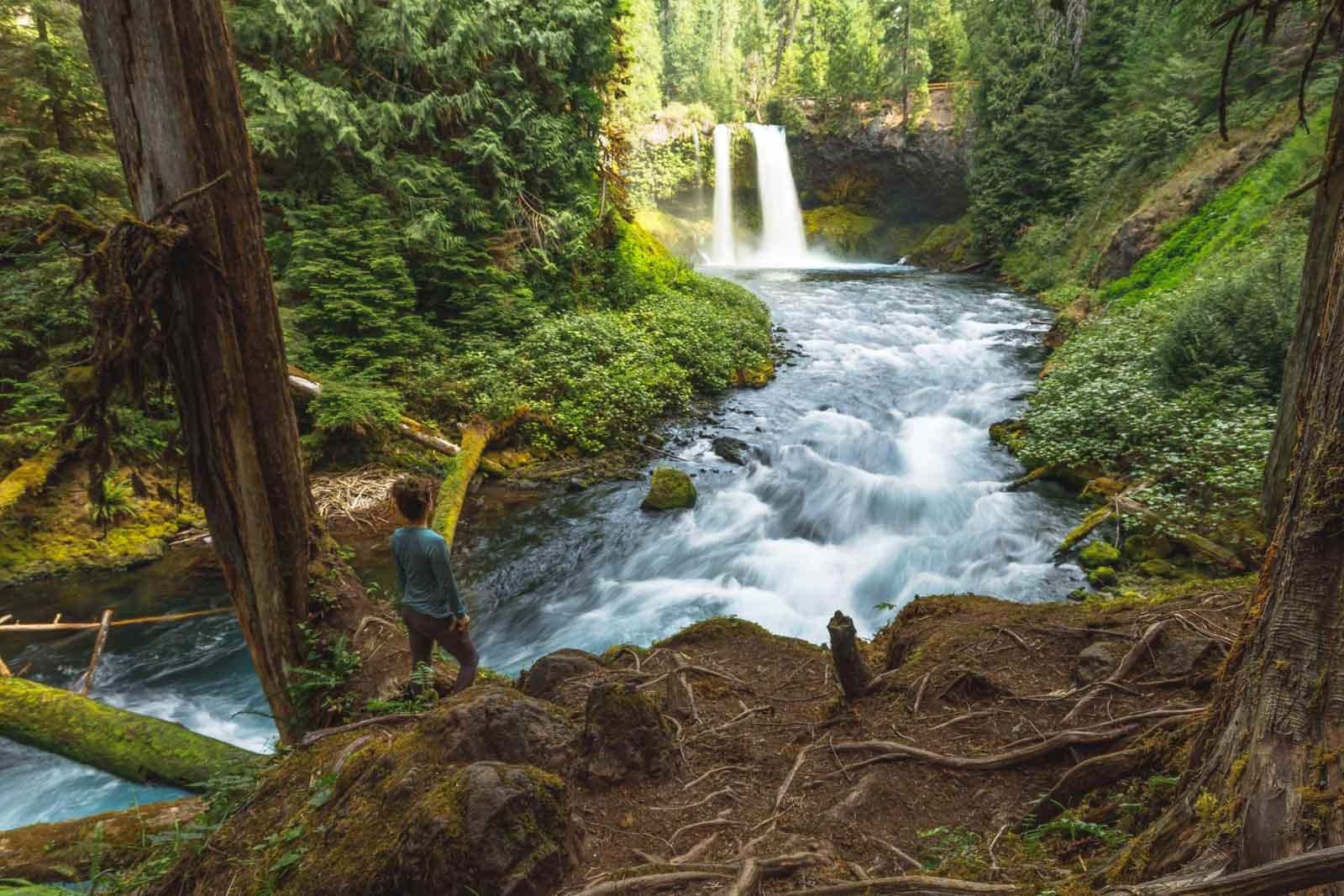
Sahalie and Koosah Falls
Ok, so technically these are two waterfalls, but since they’re connected by an easy, family-friendly 2.6-mile loop trail, we just had to combine ‘em! Koosah and Sahalie Falls are located in the Cascade Mountains. The hike borders the McKenzie River through the towering forest. Koosah Falls drops approximately 70 feet into a deep pool. Sahalie Falls is a mass of foaming white water plunging 100 feet over a natural lava dam. If Sahalie Falls looks familiar, it’s because the waterfall is famously featured in the 1993 Disney film “Homeward Bound.”
Photo: Oregon Is For Adventure
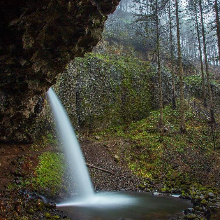
Horsetail and Ponytail Falls
You could spend several days exploring all of the amazing waterfalls of the Columbia River Gorge. It’s nearly impossible to recommend just one (which is why we’re pairing these two together!). Named for its characteristic form, Horsetail Falls plunges 176 feet within view of the Historic Columbia River Highway's "Waterfall Corridor." Just east of the falls is a great picnic spot to enjoy the beauty of the surrounding area. This is also the trailhead for Horsetail Falls Trail #438, a short but steep hike that passes behind the base of Upper Horsetail Falls (also called Ponytail Falls) and through a basalt half-tunnel before leading to Oneonta Trail #424. Note: a Timed Use Permit is required to access this section of the Columbia River Gorge during the summer months and is available on recreation.gov. Find more information at waterfallcorridorpermits.org.
Photo: Friends of the Columbia Gorge
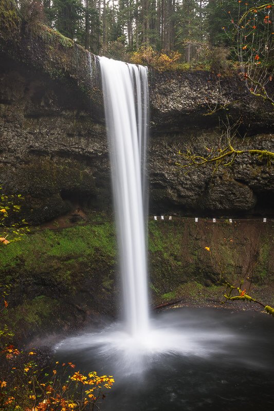
South Falls
Another multi-falls gem, Silver Falls State Park makes our list for a variety of reasons. It’s the “crown jewel” of the Oregon State Parks system. Once you visit, you’ll understand why. You can walk behind the 177-foot South Falls and hike the spectacular Trail of Ten Falls. The trail passes a series of breathtaking waterfalls along a rocky canyon, and descends to a winding creek at the forest floor. This moderate, 7.2-mile loop features an elevation change of 800 feet. Several connecting trails with separate access points make shorter routes. Expect to spot a wide variety of flora and fauna—butterflies, salamanders, rabbits and deer call this state park home. Silver Falls camping area offers tent sites, RV spots, cabins, and a horse campground.
Photo: Northwest Waterfall Survey
Idaho
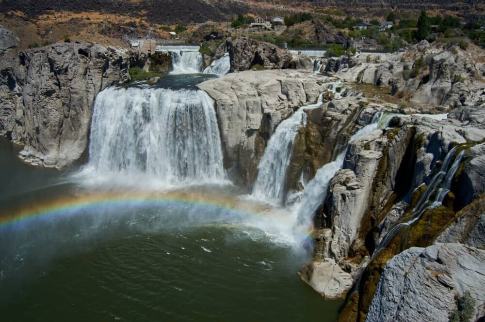
Shoshone Falls
Known fondly as the “Niagara of the West,” Shoshone Falls is a must-see attraction in Twin Falls. It’s 212 feet tall and 900 feet wide, making it one of the largest natural waterfalls in the U.S. (surpassing the height of the famous Niagara Falls by 45 feet). Located on the Snake River, Shoshone Falls carves its way through a deep basalt Canyon en route to the Columbia River. For centuries, the falls served as an important fishing and trading place for Native Americans. Tourists flocked to the site as early as the mid-19th Century when travelers along the Oregon Trail would detour from their long journey to visit the falls.
Photo: Julie Barber
Ready to Explore the Best PNW Waterfalls?
Hit the road in a vintage or modern camper van! Our rental team is happy to provide further recommendations for a dreamy PNW road trip.
